About This Trek
Everest Three Passes Trek
The 18-Day Everest Three Passes Trek by Desire Adventure is the definitive circuit for experienced trekkers seeking the ultimate high-altitude challenge in the Khumbu region. This demanding loop bypasses the commercial crowds to cross three iconic mountain passes; Renjo La, Cho La, and Kongma La all scaling above 5,400 meters. Combining these wild crossings with visits to Gokyo Lakes, Everest Base Camp, and the Kala Patthar viewpoint, our fully-supported package provides elite local guiding, safety-first acclimatization, and transparent mountain logistics.
The Clockwise Advantage – The Desire Adventure Strategy
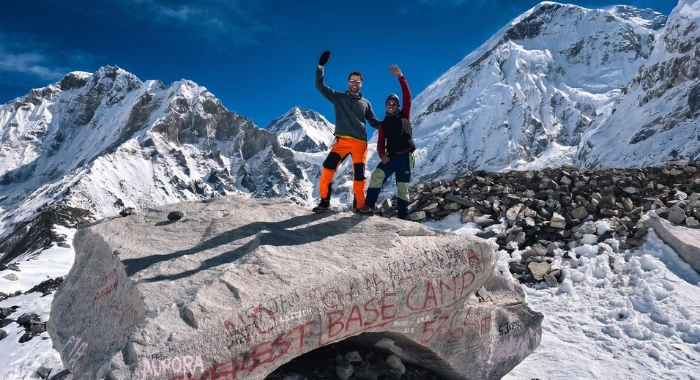
When researching the Three Passes, you will notice operators split between two directions. Many run the route counter-clockwise, pushing straight up toward Chhukung to cross Kongma La first. At Desire Adventure, our mountain guides firmly reject that layout. Our standard 18-day itinerary is purposefully designed to run in a Clockwise direction, heading out through Thame to tackle the Renjo La Pass first.
Here is why this strategic layout gives you a vastly superior safety profile and an unforgettable mountain experience:
A Gentler, Safer Adaptation to the Altitude
Acclimatization is entirely a numbers game. Going counter-clockwise forces you to tackle the Kongma La Pass (5,535m) early in the trek the highest and physically toughest of all three crossings-when your body is still building red blood cells. By going clockwise, we follow a more progressive altitude gradient. Walking through Thame and spending nights at Lumde allows your body to slowly and comfortably adapt to the thinning air. By the time you reach your first pass at Renjo La, your system is fully prepared, massively reducing your risk of Acute Mountain Sickness (AMS).
Hitting the Most Spectacular Views Front-Face
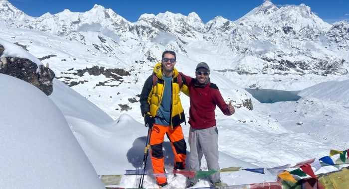
The landscapes of the Khumbu are highly directional. When you cross the Renjo La Pass from the clockwise side, you reach the summit ridge and are hit with an immediate, jaw-dropping panorama: Mount Everest sits perfectly dead-center in your frame, flanked by Lhotse and Makalu, with the turquoise Gokyo Lakes resting directly below you. If you trek counter-clockwise, this world-class view is constantly at your back, forcing you to turn around repeatedly while hiking down loose rock.
The Ultimate Technical Progression
Every pass has its own distinct personality. Renjo La is essentially a long, steep stairclimber on rock-a perfect introduction to high-altitude passes. Cho La introduces a technical glacier crossing that requires microspikes, while Kongma La demands navigating a maze of massive open moraine boulders. Going clockwise lets you build your confidence, trail footwork, and mental stamina across these terrains progressively, rather than throwing you into the most grueling section on day one.
What's covered
Includes & Excludes
✓ Included
- Round-trip arrival and departure transfer service between Tribhuvan International Airport and your hotel via a private vehicle.
- 2 nights of twin-sharing accommodation at a Tourist Star Standard Hotel, including breakfast.
- Peak-Season Transit (April–May & October–November): Round-trip transit between Kathmandu and Ramechhap Airport via a shared minivan, plus your Ramechhap-Lukla-Ramechhap mountain flight.
- Off-Peak Transit (June–September & December–March): Round-trip Kathmandu airport transfers for domestic flights via a private vehicle, plus your direct Kathmandu–Lukla–Kathmandu mountain flight.
- Daily breakfast, lunch, and dinner cooked fresh at the mountain lodges for the duration of the trek.
- A serving of seasonal fruits provided every single day after dinner throughout the trek.
- All nights in local tea houses and lodges along the route on a twin-sharing basis.
- 5 nights of premium rooms with attached bathrooms and hot showers included at key lower transitions (1 night in Phakding, 3 nights in Namche Bazaar, and 1 night in Lukla).
- Unlimited purified drinking water provided during the trek (except at the extreme altitude of Gorak Shep).
- Full coverage of the Sagarmatha National Park entrance fee and the local rural municipality entrance fee.
- A government-licensed, English-speaking, experienced, and knowledgeable local guide, including his salary, food, lodging, and transport.
- 1 dedicated porter for every 2 trekking members to carry your main luggage, including his full daily expenses.
- Comprehensive medical and accidental insurance coverage for both your guide and porter team.
- All applicable local, regional, and government taxes included.
- A complimentary, heavy-duty company duffle bag and an official physical trekking route map.
- Access to a group basic first-aid kit equipped with a digital pulse oximeter managed by your guide.
- Free logistical coordination and emergency communication support from our head office if required.
- An official adventure certificate from Desire Adventures verifying your successful trek.
- A complimentary traditional farewell dinner in Kathmandu on your final evening.
✕ Excluded
- Nepal Entry Visa: Fees payable in cash directly upon your arrival at the airport terminal in Kathmandu.
- City Meals: Lunches and dinners in Kathmandu (except for the included farewell dinner).
- Personal Beverages: All personal drinks on the trail, including bottled mineral water, specialized teas, barista coffees, soft drinks, and alcoholic beverages.
- Lodge Services: Extra hot showers taken outside of the 5 included nights, daily fees for using satellite Wi-Fi tokens, and device battery charging or laundry services at the tea houses.
- Flight Luggage Excess: Fees for any baggage exceeding the strict 15 kg (33 lbs) weight limit on mountain flights to and from Lukla.
- Travel Insurance: A compulsory personal policy that explicitly covers trip cancellation and emergency medical helicopter evacuation above 5,000 meters.
- Early Return Costs: Any extra hotel accommodation and meal expenses in Kathmandu if you choose to return from the mountains early due to fitness, illness, or personal choices.
- Trip Extensions: Costs associated with adding extra days, alternative side routes, or extending your city stay.
- Staff Gratuities: Tipping for your trekking guide, porters, and drivers as a direct appreciation for their hard work on the trail.
Day by Day
Full Itinerary
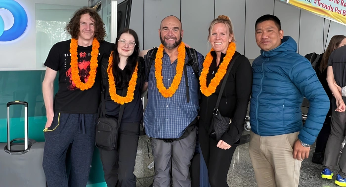
Welcome to Nepal! The moment you step out of the arrivals terminal at Tribhuvan International Airport, a Desire Adventures representative will meet you and drive you straight to your hotel in a private vehicle. After checking in, you have the morning to rest and unpack.
In the afternoon, head over to our head office for our pre-trip meeting. You will meet your tour guide, connect with your fellow travelers, and get a complete briefing on the trail logistics. Afterward, head back to your hotel to prep your gear for an early morning start.
Insider Guide Tip: Have your passport, two printed passport-size photos, and exactly $30 or $50 USD in crisp, unmarked cash ready in your carry-on bag. Having the exact change makes navigating the "Visa on Arrival" kiosk and payment counter at Kathmandu customs significantly faster.
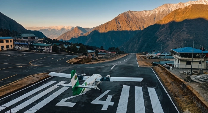
Your day starts early with a midnight drive around 1:00 AM to 2:00 AM. We head to the Manthali Airport in Ramechhap via a shared jeep to catch the peak-season morning flights. At dawn, you'll board a twin-otter aircraft for a thrilling, scenic 15-minute flight parallel to the snow-capped Himalayas, landing on the inclined runway of Lukla's famous Tenzing-Hillary Airport.
In Lukla, you will meet your private porters. While they organize the duffle bags, enjoy breakfast backdropped by towering mountain walls. We then head through the narrow streets, pass the police checkpoint to register your passport and trekking card, and walk through the Pasang Lhamu Memorial Gate. The trail drops down to Cheplung village and winds through community forests to a suspension bridge over the Thado Koshi Khola, offering views of the Dudh Koshi River and Kusum Kangru.
We climb around the ridge to Ghat, passing a school and a massive complex of mani walls, chortens, and boulders engraved with Tibetan mantras. After winding through pine forests beside the river to Chhuthawa, we reach Phakding. If you have energy after checking in, we'll take a short acclimatization hike to the local hillside monastery.
Insider Guide Tip: Pack a lightweight windbreaker and your sunglasses in your daypack before leaving the jeep at Ramechhap. While the drive is warm and humid, the moment you step off the twin-otter aircraft onto the tarmac in Lukla at 2,840 meters, the mountain air will hit you with an immediate, freezing chill.
After breakfast, we cross the bridge over the Dudh Koshi River and snake through a cool pine forest along the west bank to Toktok, passing a small local hydroelectric project. The trail undulates down to Benkar past small waterfalls, crosses to the east bank, and moves through rhododendron and magnolia forests to Chumoa. A short climb brings us to Monjo, the official gateway to Sagarmatha National Park. While your guide handles the entry permits, you can check out the 3D Himalayan map and responsible trekking displays at the information center.
Past Monjo, we descend through a Kani (gateway) past huge granite bluffs carved with mantras, cross a suspension bridge, and hit Jorsale. After crossing another bridge past Jorsale, we hike along a gravel and boulder-strewn riverbank before a short climb to the Larja Bridge. Just before the bridge, look down at Larja Dobhan to see the roaring confluence of the Bhote Koshi and Dudh Koshi rivers. Once across the high bridge, we hit a viewpoint for your first glimpse of Mount Everest peeking over the Lhotse ridge. From there, it's a steep, zigzagging climb through pine forests to Mislung, where the trail levels off for a smooth final walk into Namche Bazaar, the historic horseshoe-shaped Sherpa capital.
Insider Guide Tip: Namche Hill is a mental game. When you cross the high Larja Bridge, shorten your trekking poles by 5-10 centimeters, tuck your chin down, and match your breathing rhythm to a very slow, deliberate step. Rushing up this hill to keep pace with porters is the single most common cause of early altitude headaches.
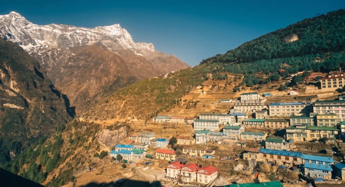
To safely cross three high passes, we practice the rule of Climb High, Sleep Low. Today is an active acclimating journey through a spectacular high-altitude village loop.
After breakfast, we take the path above Namche Gompa, climbing a steep, zigzagging ridge to Zarok. We push up to the grassy alpine airstrip at Shyangboche and follow a sandy gully between juniper bushes up to the valley of Khunde. At the top of the ridge, we pass carved boulders and a Boudhanath-style chorten to visit the Khunde Tsamkhang temple, offering views of Ama Dablam, Thamserku, and the sacred peak of Khumbila. Next, a side trail leads to the Hillary Memorial Viewpoint for a 360-degree panorama of Pachermo Peak and Namche, where you can see the memorial chortens built for Sir Edmund Hillary's wife and daughter.
We then hike east through high potato fields to Khumjung, the largest village in the region. Here, we visit the Hillary School and the local Khumjung Gompa, which famously treasures what is said to be a real "Yeti Skull." To finish the loop, we take the trail behind the school back to the northern end of the Shyangboche runway and drop back down into Namche for a free evening to enjoy the local bakeries and internet cafes.
nsider Guide Tip: Use the free afternoon in Namche to purchase your microspikes (slip-on boot chains) and extra batteries. Cho La Pass requires crossing an active, slippery glacier sheet, and microspikes are mandatory for safety. Also, keep your camera and phone batteries wrapped in a wool sock inside your pack-the high altitude drains lithium cells even when not in use.
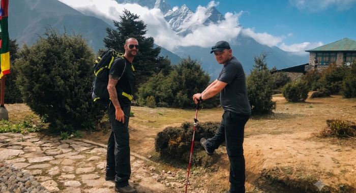
Today we leave the main tourist highway behind and branch west toward the isolated valley of Thame. After breakfast, we take the high trail past Namche Gompa, walking through a quarry and passing massive mani boulders before hitting the Shyangboche turn-off. From here, our path winds through pine and rhododendron woods to an ancient, mud-plastered stupa in the village of Phurte.
We loop around the ridge to Samshing, where a large boulder displays a painted image of Guru Rinpoche, then pass a large chorten to cross the stream at Tesho. Heading west, we climb a ridge through rhododendron forests to Thamo. At the top end of Thamo, we pass Khari Gompa and enter a dry, dusty landscape, climbing steadily to the stone houses of Somde.
After one final steep climb, the trail drops sharply to a bridge over the Bhote Koshi River, set against a cliff wall covered in enormous murals of Green Tara, Guru Rinpoche, and Thangtong Gyalpo. After crossing, a steady 20-minute climb brings us into Thame. In the afternoon, we'll take a walk up the sandy ridge to Thame Gompa to admire its ancient murals and look out over the wild valley.
Insider Guide Tip: As you pass through the village of Thamo, look out toward the cliffs across the river gorge. If you scan the rocky ledges carefully, this is one of the best areas in the Khumbu to spot wild Himalayan Thar (large mountain goats) grazing on the sheer vertical rock faces.
We have breakfast in Thame before descending over the glacial moraine to the chorten at the bottom of the village. From here, it’s a gentle, scenic stroll up the alpine valley floor to Thambuteng, passing the small Kyaro Gompa and crossing the bridge over the Langmuche River.
Once across, we hike up to the farming settlement of Tarang. The landscape begins to shift dramatically here, becoming more barren and wild as we push past the tree line. We walk down to cross a bridge over the Chhudungbo River, then follow the rocky west bank of the Bhote Koshi River, climbing steadily for about 50 minutes to reach Marlung. Just before pulling in, we cross another bridge over the Bhote Koshi to reach the eastern bank. From Marlung, a final hour of uphill walking along the eastern bank brings us into Lumde, our final high-altitude resting point before we tackle our first major mountain pass tomorrow.
Insider Guide Tip: You are entering the high-alpine zone where trees disappear completely. Buy a lightweight buff or dust scarf to wear over your mouth and nose from today onward. The cold, dry, unoxygenated air combined with the dusty trail causes the infamous "Khumbu Cough"-keeping your airways moist is your best defense.
Today we conquer the first of the three high passes. After a hearty breakfast, we leave the trail that leads to the Tibetan border at Nagpa La and turn right, climbing the eastern slope of the Thame Valley. The Renjo La trail climbs steeply through a narrow valley packed with giant boulders before opening into the sandy valley of the Renjo River. We ascend along a wide, dusty path north of the valley, passing the trail to Relama Tsho and reaching the shores of the frozen Angladumba Tsho lake.
From the lake, your footwork is tested as we climb a steep, winding staircase built from massive stone slabs that are often covered in ice. At the summit of Renjo La (5,360m), you are hit with a world-class panorama: Mount Everest sits perfectly dead-center, flanked by Lhotse, Makalu, and Gyachung Kang, with the turquoise Gokyo Lakes visible down below. After enjoying the view, we descend a large, S-shaped trail to the base of the ridge.
The path splits and wraps around a mountain bowl before meeting up again for a final switchback descent to the northern shore of the third Gokyo Lake, leading straight into the lakeside village of Gokyo. If you have any energy left, a short walk up the ridge to view the massive Ngozumpa Glacier is highly recommended.
Insider Guide Tip: The stone steps leading up the final 200 vertical meters to the Renjo La ridge are often coated in slick, transparent black ice formed from freezing morning condensation. Do not rush this section. Place your boot completely flat on each stone slab and test your balance with your poles before transferring your body weight.
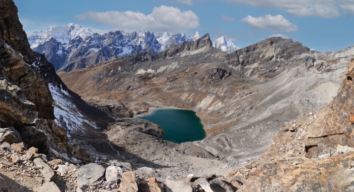
Because yesterday was an exhausting push over the pass, today's itinerary is intentionally short to let your muscles recover. After breakfast, we hike up the steep glacial moraine directly behind Gokyo village. Make sure to look back-you'll get a beautiful view of the entire village mirrored on the still surface of the third lake.
Leaving the water behind, we descend the inner wall of the moraine onto a changing landscape of loose rock, sand, and scree. We spend the morning navigating across the Ngozumpa Glacier-the longest glacier in the Himalayas. The trail here shifts constantly due to the moving ice beneath, requiring you to hike up and down small scree slopes and step over boulders. As we reach the lateral moraine on the opposite side of the glacier, we pass a beautiful, deep-blue frozen lake. Following the trail above the water, we climb the final scree slope back onto solid ground. A short walk along a flat stretch of land between the moraine and the mountain wall brings us into Thaknak. To help your body keep acclimatizing, your guide will take you on a short afternoon hike up the nearby hills.
Insider Guide Tip: The path across the Ngozumpa Glacier is an active debris field, meaning the trail changes constantly as the ice melts and shifts beneath the boulders. Keep your eyes locked on your guide-do not follow old footpaths or rely on smartphone GPS maps here, as rockfalls can create dead-ends overnight.
Our goal is to clear the pass before the noon winds pick up, so we start before dawn with a packed lunch in our packs. Leaving Thaknak, we walk up a small, barren valley for two hours to reach a high ridge. From here, look across the moraine to see the high saddle between two jagged peaks-your first look at the Cho La Pass.
We drop down into a valley left behind by a receded glacier and make our way through a tough landscape of massive boulders to reach the base of a steep cliff. Following small stone cairns, we begin a long, challenging climb up a zigzagging trail of loose rock and scree. Reaching the top of Cho La (5,420m), you'll see a tangle of prayer flags framed by views of Cholatse and Ama Dablam to the southeast, and Pharilapche to the west.
The journey continues with a steep descent down a rocky slope directly onto the glacier itself. Walking carefully along the slippery ice path, we reach the terminal moraine where the ice ends, continuing on a rocky trail to a cliff that looks down into the valley below. We hike down to the flat valley floor, follow a glacial stream over the crest of the ridge, and make our final push into Dzongla.
Insider Guide Tip: Put your microspikes on the very moment you step off the loose rock onto the hard-packed glacier ice past the pass summit. Trying to walk across the sloping, slick ice sheet in plain hiking boots-even with deep rubber lugs-is incredibly dangerous and causes frequent slips and wrist injuries.
After breakfast, we trek down a rocky slope to a mountain stream. After crossing, we gradually gain elevation along the ridge, keeping the deep Chola Tso lake and the peaks of Cholatse and Taboche to our right. The path eventually meets up with the busy, main Everest Base Camp trail.
From this junction, we turn north for a challenging hike over loose, rocky moraine that leads into Lobuche. Past Lobuche, the trail narrows significantly, running through a gap between the mountain wall and the massive lateral moraine of the Khumbu Glacier. We pass the trail leading to the high-tech Italian Pyramid research station, then tackle a few short, steep climbs over the terminal moraine of the Changri Glacier. After navigating the loose rocks across the glacier, we make a final push into Gorak Shep. This high settlement welcomes you with views of Pumori, Lingtren, Khumbutse, and Changtse. We check into the lodge and save our energy for the push to Base Camp tomorrow.
Insider Guide Tip: The junction where the Dzongla trail meets the main Everest Base Camp highway gets incredibly busy with pack animals. When a herd of yaks or dzo approach you on the narrow moraine tracks, always step to the hillside (upper slope) of the trail to let them pass. Stepping to the cliffside risks being accidentally bumped off the edge by a wide yak load.
Today is the day you stand at the base of the world's highest peak. After breakfast, we head out of Gorak Shep and step directly onto the moraine wall of the Khumbu Glacier. The trail undulates continuously over loose dirt, shifting rocks, and icy patches as we track alongside the glacier.
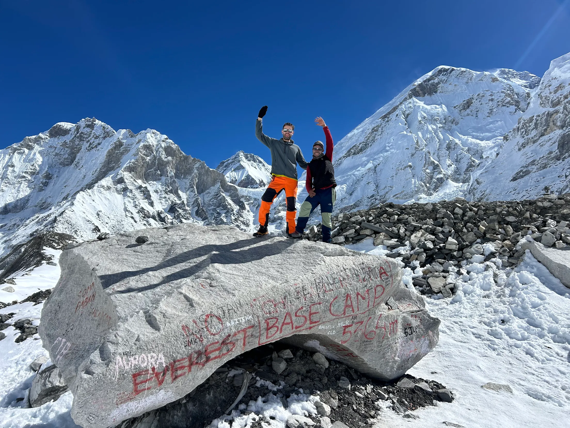
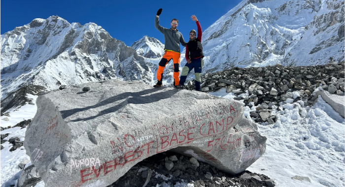
As we near our goal, the massive, chaotic ice towers of the Khumbu Icefall come into view. A large boulder covered in colorful prayer flags and signatures marks your arrival at Everest Base Camp (5,364m). While the true summit of Everest is hidden from the base camp by the high ridges of Nuptse, standing directly in the bustling basin where historic expeditions launch their summit bids is an incredible experience. We will spend some time taking photos, celebrating, and soaking in the glacial views before retracing our steps along the moraine wall back to Gorak Shep for a warm meal and a well-earned night of rest.
Insider Guide Tip: Because Everest Base Camp sits directly on a moving glacier, the ground is a mix of loose moraine ice and sharp shale. Ensure your boot laces are tied tightly around your ankles to avoid rolling a joint on the undulating, rocky terrain, and keep your headlamp in your pack just in case cloud cover rolls in early.
We wake up about two hours before dawn in the sub-zero cold to catch the sunrise over Mount Everest. The trail up Kala Patthar consists of a long series of steep, relentless switchbacks. It levels off slightly on the eastern side of the mountain before a final, steep rock scramble up the summit ridge.
At the top of Kala Patthar (5,550m), you are greeted by wind-lashed prayer flags and a panoramic view of the central Himalayas. This is the highest point of your entire trek. From here, you can see the true summit of Mount Everest glowing in the first morning light, framed by Nuptse, Lhotse, Pumori, and Lobuche West. You can also look straight down onto the tents of Everest Base Camp and the entire length of the Khumbu Glacier. After taking photos and making memories, we retrace our path down to Gorak Shep for a hot breakfast. We then pack our bags and head back down the trail, crossing the Changri Glacier moraine to Lobuche for the night.
Insider Guide Tip: The pre-dawn climb up Kala Patthar is brutally cold, with temperatures regularly dropping below -15°C. Layer up with your heavy down jacket over your fleece, wear thermal gloves, and keep your phone or camera tucked into your inner chest pocket right against your body heat to keep the battery from dying before sunrise.
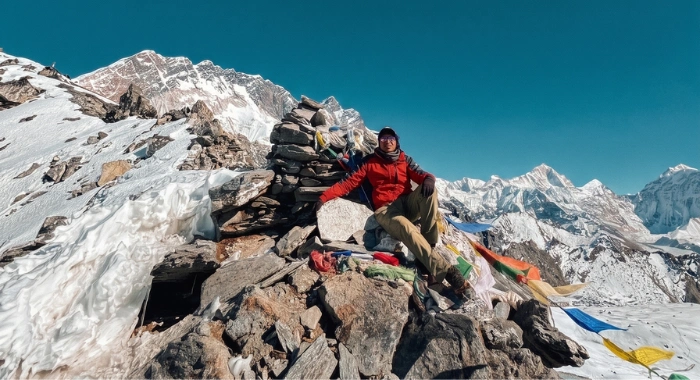
Today we tackle the third and final high pass-and physically the toughest. Carrying a packed lunch, we leave Lobuche and turn southeast, making a gentle ascent onto the Khumbu Glacier. We follow stone cairns across an undulating glacier path before climbing the opposite moraine wall, looking out at views of Pumori, Cholatse, and Taboche behind us.
Leaving the moraine, we hit a steep trail of loose scree and icy boulders that climbs relentlessly up to Kongma La (5,535m). Marked by a stone cairn wrapped in prayer flags, the pass offers a rugged view of an icy lake below, backed by Lhotse, Lhotse Shar, Makalu, and Ama Dablam. From the ridge, the trail drops sharply, switching back over loose scree to a wide basin dotted with frozen lakes. We continue descending steeply west down a boulder-strewn slope, tracking along the east side of the Niyang Khola Valley beneath a massive wall of black rock to Langbo. From here, we walk east over the outflow of the Nuptse Glacier into Chhukung, enjoying views of Island Peak and Amphu Lapcha.
Insider Guide Tip: Kongma La is the highest, longest, and most isolated pass of the three. There are absolutely no teahouses, sheltered huts, or water sources between Lobuche and Chhukung. You must fill your Nalgene bottles with at least 3 liters of water and keep your packed lunch easily accessible in your daypack before leaving the lodge.
With all three passes successfully conquered, we begin our descent back down the main valley. After breakfast, we hike southwest past the tiny settlement of Bibre, meeting up with the standard trekking trail at Chubejung Kharka. We follow the path along the Imja Khola riverbed to the village of Dingboche.
From Dingboche, the trail drops down the valley floor to Orsho and continues along the west bank of the Imja Khola to Somare. If you still have energy, we can take an uphill side trail just past Somare to visit the ancient monastery in upper Pangboche. Otherwise, we continue down the main trail through Pangboche, dropping to the riverside hamlet of Deboche.
From Deboche, we make one final climb through a rhododendron forest to reach the ridge of Tengboche. Tengboche offers a mountain view of Everest, Lhotse, and Ama Dablam. After checking in, your guide will take you on a tour of the historic Tengboche Monastery Complex and the Eco Center.
Insider Guide Tip: If your knees are sore after three high passes, take advantage of the flat, smooth pastures between Dingboche and Orsho to stretch out your stride. When you reach Tengboche Monastery in the afternoon, remove your boots and hat before entering the main prayer hall as a vital sign of cultural reverence.
In the morning, you have the option to wake up early and join the resident monks for their morning prayers inside the main monastery hall. After breakfast, we leave Tengboche and make a steep descent through a forest of mature rhododendrons, passing water-driven prayer wheels to reach the river at Phunki Tenga.
From the river crossing, we climb a steep series of stone steps up the opposite ridge to Leushyasa. The trail then flattens out into a smooth, scenic path that hugs the high ridge line, offering views of Ama Dablam as we walk to Sanasa. From Sanasa, we follow the level path along the ridge to Chhorkung, looping back around the mountain bowl into Namche Bazaar. You have the afternoon free to celebrate your return to civilization, grab a coffee at an internet cafe, or relax at the lodge.
Insider Guide Tip: The descent down the steep stone steps from Tengboche to the river at Phunki Tenga is notorious for causing toe blisters. Tap your heels back into your boots and tie your laces extra securely across the bridge of your foot to prevent your toes from sliding forward and hitting the front of your boot.
This is your final day of walking. After breakfast, we hit the level path out of Namche to Mislung, then drop down the long, steep switchbacks of Namche Hill through the pine forest to the Larja Bridge. We retrace our initial steps along the river bank past Jorsalle to Monjo, where your guide will handle the national park check-out formalities.
From Monjo, we continue our descent along the Dudh Koshi River, passing through Phakding. After lunch, the trail climbs back up the valley ridge, passing through local villages and crossing final suspension bridges before a last uphill push brings us back through the Pasang Lhamu Gate into Lukla. Tonight, we gather at the lodge for a final dinner to celebrate conquering the Three Passes with your guide, porters, and fellow travelers.
Insider Guide Tip: This is a very long, demanding 8-hour walking day because your body is already carrying the fatigue of the past two weeks. Take a brief resting break at Phakding to fuel up on carbohydrates and hydrate before tackling the final, gradual 200-meter uphill climb back into Lukla.
After an early breakfast, we head to the Lukla airport to catch our morning flight back to Ramechhap. Once the plane touches down at Manthali Airport, we say goodbye to the mountains and board a shared minivan for the 4-to-5-hour drive back along the highway to Kathmandu.
Upon arriving in the capital, we check you back into your hotel for a free afternoon to rest, take a long hot shower, or do some last-minute shopping around Thamel. In the evening, Desire Adventures hosts your formal farewell dinner at a local restaurant, where we can share stories from the passes, celebrate your achievement, and gather your honest feedback.
Your 18-day Everest Three High Passes expedition officially comes to an end today. After breakfast at your hotel, a Desire Adventures representative will meet you in the lobby with a private vehicle to drive you to Tribhuvan International Airport in time for your outbound flight home.
Physical Preparation
Difficulty & Fitness
StrenuousFitness level of Moderate to Good Level is required. Need to have stamina and strength to walk 5-8 hours Daily while carrying 5kg daypack.
What to Bring
Packing List
Everything you need for a comfortable and safe trek. Items marked Required are essential.
Clothing
-
Lightweight synthetic or merino wool thermal tops 3 piecesRequired
-
Mid-weight thermal bottoms (leggings) 2 piecesRequired
-
Moisture-wicking sports underwear 4 piecesRequired
-
Grid-fleece jacket 1 PieceRequired
-
Lightweight down or synthetic insulated jacket 1 PieceRequired
-
Durable, wind-resistant trekking pants 2 PieceRequired
-
Heavy-duty, high-loft down jacket with a hood 1 PieceCan Rent
Footwear
-
Sturdy, waterproof, broken-in hiking boots high-ankle support with deep rubber lugsRequired
-
Lightweight camp shoes for lounging in the tea houses after walkingRequired
-
Merino wool trekking socks 4 PairsRequired
-
Synthetic liner sock 2 Pair (helps prevent trail friction and blisters)Required
-
Microspikes mandatory for walking across the slippery Cho La glacierCan Rent
Handwear
-
Lightweight thermal liner gloves touchscreen-compatible is a plusRequired
-
Waterproof, insulated Ski gloves 1 PairRequired
Headwear
-
Wool beanie 1 PieceRequired
-
Brimmed sun hat for uv protection in the lower valleysRequired
-
UV-blocking polarizing sunglasses Category 3 or 4 to prevent snow blindnessRequired
-
Lightweight neck buffs or balaclavas crucial for protecting your lungs from the dry "Khumbu Cough"Required
Gears
-
30L to 40L Ergonomic daypack equipped with a waterproof rain coverRequired
-
Heavy-duty Desire Adventures duffle bag provided by us, carried by your porterRequired
-
Trekking Poles essential for saving your kneesRequired
-
High-lumen Headlamp mandatory for the pre-dawn climbs of Kala Patthar and Cho LaRequired
-
1-Liter durable Nalgene Bottles must be able to hold boiling waterRequired
-
Four-season sleeping bag can be rented in NepalCan Rent
-
Power BanksOptional
-
Universal travel plug adapterOptional
Toiletries
-
Biodegradable body/wet wipes your primary method of staying clean above 4,000 metersOptional
-
Quick-drying microfiber travel towel 2 PieceOptional
-
Pocket tissues and toilet paper rolls 3 PacksRequired
-
SPF 50+ Sunscreen and a dedicated UV-blocking lip balmRequired
Medical
-
Blister care kit Carried by GuideRequired
-
Broad-spectrum antibiotics and pain relief Carried By GuideRequired
-
Anti-diarrhea tablets Carried By GuideRequired
-
Anti-Altitude Medicines Carried By Guide if you plan to useOptional
Additional Information
More Details
High-Alpine Lodge Realities & Acclimatization Safety
Conquering the Three Passes Circuit means spending multiple consecutive weeks in one of the most extreme, remote high-altitude environments on Earth. Unlike shorter valley treks, this 18-day expedition requires you to live, eat, and sleep above 4,000 meters for a massive portion of the loop, hitting a maximum sleeping elevation of 5,140 meters at Gorak Shep.
At Desire Adventure, we believe that setting realistic expectations about high-alpine infrastructure is the key to mental stamina and physical safety. Here is a transparent look at what lodge life is actually like on this advanced circuit, and how our team manages your health in the thin air.
High-Alpine Lodge Realities: What to Expect Above the Tree Line
The tea houses in the remote corners of the Khumbu-such as Lumde, Thaknak, Dzongla, and Gorak Shep-are remarkably resilient, family-run outposts. Because every single piece of building material, gas cylinder, and food item must be flown into Lukla and then hauled up by yaks or porters over high mountain passes, comfort amenities shrink as altitude increases.
Freezing Overnight Temperatures: Bedrooms are entirely unheated, basic twin-sharing rooms with wooden partition walls. Past 4,000 meters, indoor plumbing is physically impossible because pipes freeze solid overnight. You will use clean, shared communal toilets (often basic drop-toilets or manual flush buckets). Overnight indoor temperatures regularly plunge well below freezing (0°C to -10°C). A heavy-duty, four-season sleeping bag rated down to -15°C is mandatory to ensure restorative sleep.
The Dining Hall Hearth: The central communal dining room is the social hub of the lodge. It is the only room that is heated in the evening, using a traditional iron stove fueled by dried yak dung. We gather here every evening to dry out damp gear, share stories, drink hot tea, and rest your leg muscles.
Resource Fees (Wi-Fi, Power, and Showers): Everything in the high-alpine zone relies on solar power grids and satellite links. Lodges charge localized cash fees (paid in Nepali Rupees) for extra amenities. Device charging costs roughly $3 to $6 USD per item, while satellite Wi-Fi access tokens cost between $5 to $10 USD. Hot showers become increasingly scarce and expensive past Namche Bazaar. We include 5 hot showers at strategic low-altitude transitions in your package, but we strongly advise using body wipes instead of showering once you sleep past 4,000 meters to avoid catching a severe chill.
High-Altitude Nutrition: Clean Fueling for Severe Cold
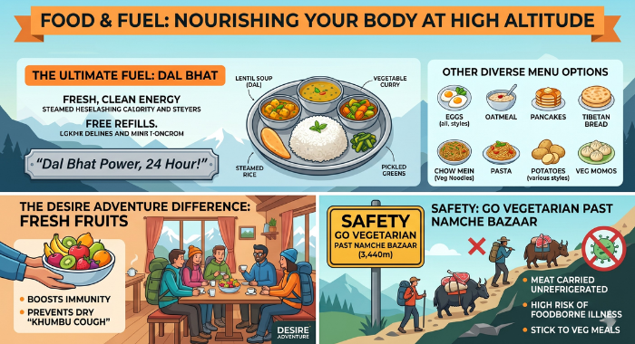
When walking over rugged passes for 7 to 9 hours a day in sub-zero weather, your metabolism shifts into overdrive. Your body burns calories at a massive rate just to generate body heat and keep your respiratory system functioning in hypoxia (oxygen-thin air).
The Power of Fresh Carbohydrates: Our menus feature nutrient-dense mountain food like porridge, eggs, pasta, and potatoes. Our absolute staple is fresh Dal Bhat (the traditional Nepali rice, lentil soup, and vegetable platter). It is packed with clean, slow-burning carbohydrates, completely free of heavy fats, and comes with free refills to guarantee you are fully fueled. To supplement your recovery, Desire Adventure provides fresh seasonal fruits after every dinner to keep your immune system strong.
The Strict Vegetarian Rule: We strongly enforce a strict vegetarian diet for our clients once we trek past Namche Bazaar. There is zero refrigeration in the high-alpine tea houses. Any meat products on the trail have been carried on the backs of porters or yaks exposed to the sun for days, making them a primary cause of severe stomach bugs that can instantly ruin a trek.
Advanced Acclimatization & Safety Metrics
The "Climb High, Sleep Low" protocol is built into the core structure of our clockwise itinerary. We don't just walk the loop; we manage your adaptation dynamically every day.
Daily Pulse Oximeter Monitoring: Every single evening in the dining hall, your guide will use a digital Pulse Oximeter to record your resting heart rate and blood oxygen saturation. By creating a daily health baseline starting from your arrival day, your guide can spot fluid retention or early physiological changes before you even feel the physical symptoms of Acute Mountain Sickness (AMS).
The Hard Safety Line: If a trekker shows persistent signs of moderate AMS (unyielding headache, continuous vomiting, or mild confusion), the ascent stops immediately. Because our group departures run on a highly structured 1:5 Guide-to-Client ratio, we have the field staff flexibility to safely split a group. A secondary guide can immediately escort an ailing trekker down to a safer, lower elevation (such as dropping from Gorak Shep back to Lobuche or Dingboche), while the rest of the group continues over the pass without interruption.
High-Altitude Safety & Evacuation Operations
Crossing three high mountain passes over 5,400 meters-Renjo La, Cho La, and Kongma La-requires a level of safety planning that goes far beyond a standard valley trek. On this circuit, you aren't just visiting the high-alpine zone; you are living and sleeping above 4,000 meters for multiple consecutive days. At this elevation, atmospheric pressure drops significantly, and the available oxygen is nearly half of what it is at sea level.
At Desire Adventures, we don't treat safety as a reactive backup plan-it is a continuous, daily operational routine managed by our veteran guiding team. Here is exactly how we protect your health and manage logistics in the high-alpine environments of the Khumbu.
Daily Health Screenings: The Vital Check
We catch altitude complications before they show physical symptoms. Every single evening in the dining hall, your guide will open our company medical kit and perform a mandatory health check using a digital Pulse Oximeter.
Tracking Your Saturation: We measure and log your blood oxygen saturation level along with your resting heart rate. By establishing a daily health baseline from the moment you land in Lukla, your guide can instantly see how your cardiovascular system is adapting to the thin air.
Proactive Decision Making: If your oxygen levels drop below safe thresholds or your resting heart rate spikes dramatically while you are sitting still, it tells us your body is struggling to adapt-long before you develop a severe altitude headache or nausea. This data allows us to make smart trail adjustments, such as slowing your pacing, increasing hydration, or building in extra rest.
Strict Altitude Mitigation & The Group Split Protocol
If a trekker begins showing early signs of Acute Mountain Sickness (AMS), our team acts immediately according to strict high-altitude safety guidelines:
The Ascent Halt: We never allow an ailing trekker to continue climbing higher to "see how they feel at the next camp." The moment symptoms appear, that altitude is your ceiling.
Immediate Descent: The absolute best medicine for altitude sickness is dropping to a lower elevation. Moving down just 300 to 500 vertical meters rapidly reverses mild to moderate AMS symptoms.
The Safe Group Split: Because we maintain a strict 1:5 Guide-to-Client ratio for our groups, we have the staff flexibility to handle splits on the trail. If you need to descend for your health, a secondary licensed guide will personally escort you down to a lower, safer village (such as moving from Gorak Shep back to Lobuche or Dingboche) to recover. Meanwhile, the lead guide continues over the mountain pass with the rest of the group. You are never left alone, and the group's journey is never compromised.
High-Altitude Helicopter Evacuation Workflows
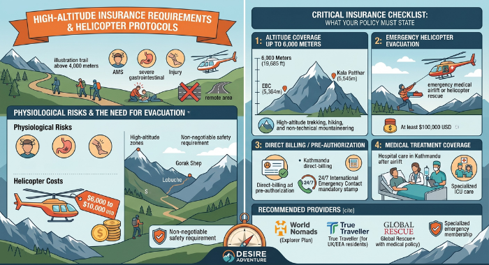
In severe medical situations-such as advanced altitude complications (HAPE or HACE) or acute physical injuries-an immediate emergency helicopter evacuation is required.
24/7 Kathmandu Command Base: Our guides carry satellite and local communication networks to maintain an open line with our Kathmandu head office. The moment your guide determines an evacuation is necessary, our city team contacts your travel insurance provider’s emergency desk to secure flight clearance.
Weather Realities: Helicopters in the Everest region operate under strict Visual Flight Rules (VFR). This means rescue flights can only fly during daylight hours and are entirely dependent on clear valley visibility. If bad weather or thick mountain fog blocks the airspace over high hubs like Gorak Shep or Gokyo, our guiding team will immediately coordinate an alternative ground evacuation, using local pack animals or stretcher teams to carry you down to a lower, clear helipad like Pangboche or Namche Bazaar.
On the trail
Photo Gallery
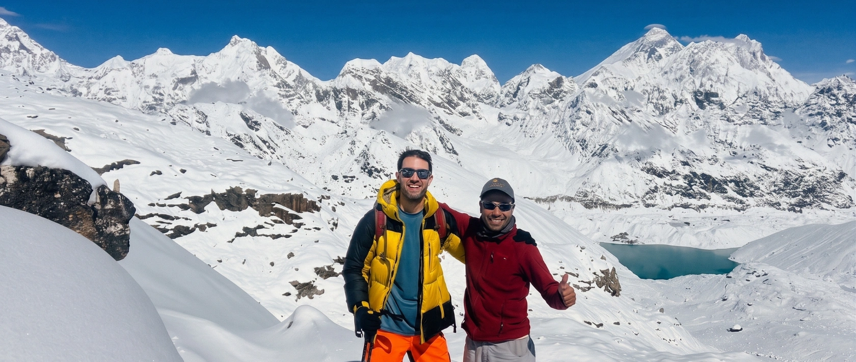
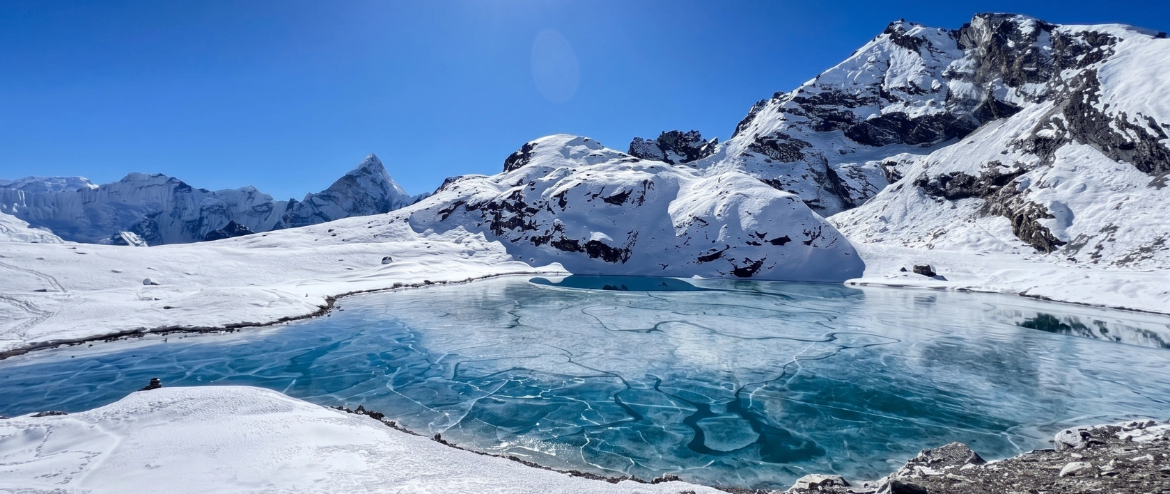
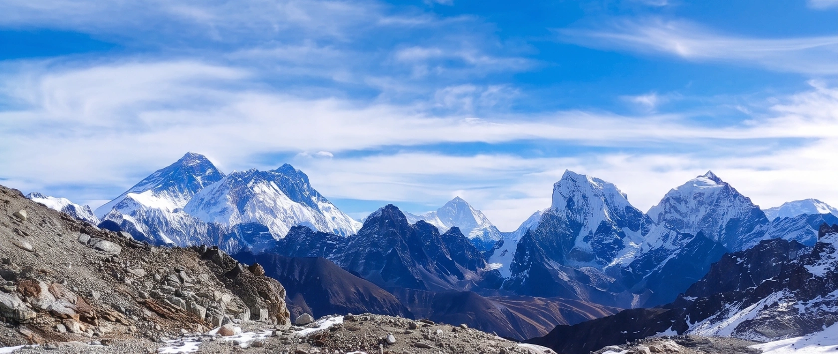
Trek Route
Route Map
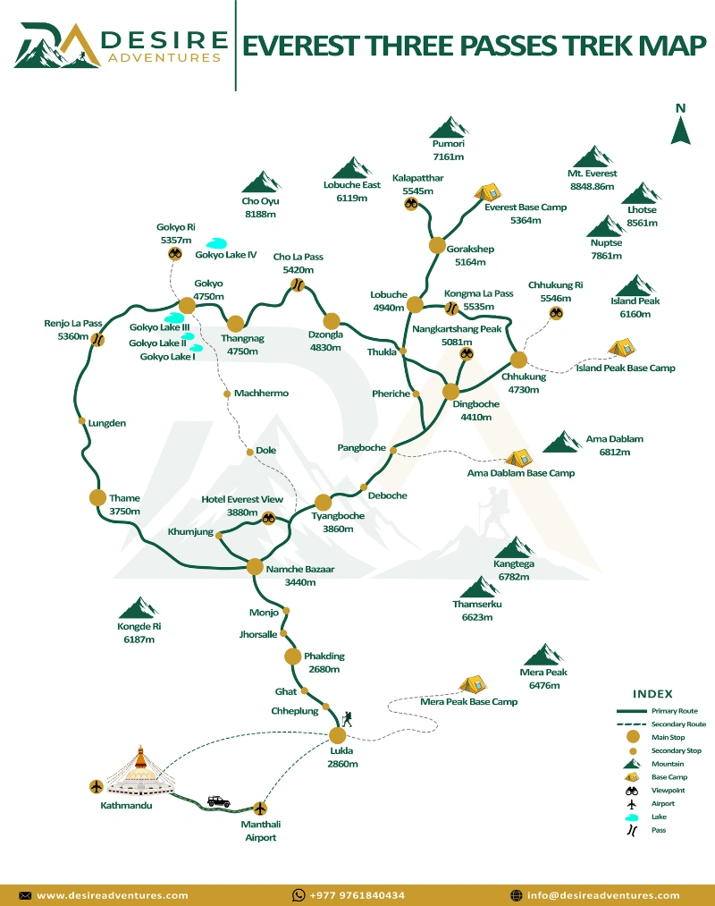
Elevation Profile
Altitude Chart
Elevation profile across 18 days. Maximum altitude: 5,140m
Common Questions
Frequently Asked
While all three crossings demand respect, most veteran guides consider the Kongma La Pass (5,535m / 18,159ft) to be the most physically grueling. Because our clockwise itinerary tackles it last, your body will be well-acclimatized, but it remains a massive day. It is the highest of the three passes and has no escape routes or teahouses along the way. The trail requires navigating a complex, ever-changing maze of open moraine boulders across the Khumbu Glacier, making it a long, demanding 7 to 8-hour endeavor.
To reduce severe air traffic congestion at Kathmandu’s international airport during the busiest trekking months, the Civil Aviation Authority of Nepal reroutes all Lukla flights to Manthali Airport in Ramechhap during the peak spring (April to May) and autumn (October to November) seasons. During these months, Desire Adventures arranges a shared minivan to transfer you to Ramechhap at midnight (around 1:00 AM to 2:00 AM) so you can catch the earliest morning flights. During the shoulder or off-peak months, flights revert to operating directly out of Kathmandu.
Yes, microspikes are absolutely mandatory for this trek. When crossing the Cho La Pass (5,420m) from the clockwise side, you will descend directly onto a steep, hard-packed mountain glacier sheet. Attempting to walk on this slick, solid ice in plain hiking boots-even those with excellent rubber lugs-is incredibly dangerous and a frequent cause of trail injuries. You do not need technical climbing crampons, just simple slip-on rubber boot chains. If you do not own a pair, they can be easily purchased for roughly $10 to $15 USD in the gear shops of Kathmandu or Namche Bazaar.
Your health is our priority, which is why our package includes unlimited purified or chemically treated drinking water throughout the trail. However, Gorak Shep (5,140m) is a seasonal settlement sitting on dry, frozen glacial moraine with no natural running water source. Every drop of water there must be hauled up manually by porters or pack animals from sources further down the valley or melted from glacial ice using expensive fuel. Because of this extreme scarcity, unlimited water is logistically impossible at Gorak Shep, and trekkers buy bottled water or pay a small local surcharge for boiled water directly at the lodge.
Yes, solo adventurers can absolutely book this itinerary. Because the Three Passes is a highly advanced loop with complex glacier navigation, safety rules prevent solo trekkers from walking it entirely unguided. If you book as a solo traveler, Desire Adventures will provide you with your own private, dedicated government-licensed guide and porter team to ensure complete safety. Alternatively, if you prefer a social group dynamic, we can look to match you with one of our existing small group departures.
High-altitude weather is unpredictable. If heavy seasonal snowfall or a sudden blizzard renders a high pass like Cho La or Renjo La unsafe to cross, your guide will prioritize your safety above all else. Because we maintain a flexible operational approach, we will not risk a dangerous crossing. Instead, your guide will pivot to a backup route, dropping back down the valley slightly to loop around via lower, safer connecting trails to ensure you still reach key destinations like Gokyo Lakes or Everest Base Camp without compromising your safety.
Even though your lodging, permits, guide, porters, and three main daily meals are fully covered by Desire Adventures, you will need local cash for personal comforts. We recommend exchanging money in Kathmandu and bringing roughly $25 to $35 USD (approx. 3,500 to 4,500 Nepali Rupees) per day in small denominations. This cash will cover your personal expenses like solar power charging fees, satellite Wi-Fi tokens, laundry services, extra hot showers, and snacks or hot coffees at the alpine bakeries. ATMs do not exist past Namche Bazaar.
Scheduled Group Trips
Available Departures
Join a scheduled group departure for extra discounts and a shared adventure with fellow trekkers.
| Departure Date | Return Date | Duration | Price | Availability | |
|---|---|---|---|---|---|
| 11 Sep 2026 | — | 18 Days | USD 1650 | Only 4 left | |
| 23 Sep 2026 | — | 18 Days | USD 1650 | 1 spots left | |
| 2 Oct 2026 | — | 18 Days | USD 1600 | Only 6 left | |
| 12 Oct 2026 | — | 18 Days | USD 1600 | Only 5 left | |
| 23 Oct 2026 | — | 18 Days | USD 1650 | 4 spots left | |
| 2 Nov 2026 | — | 18 Days | USD 1650 | 3 spots left | |
| 19 Nov 2026 | — | 18 Days | USD 1650 | 1 spots left | |
| 24 Nov 2026 | — | 18 Days | USD 1650 | 2 spots left |